When you click on links to various merchants on this site and make a purchase, this can result in this site earning a commission. Affiliate programs and affiliations include, but are not limited to, the eBay Partner Network.
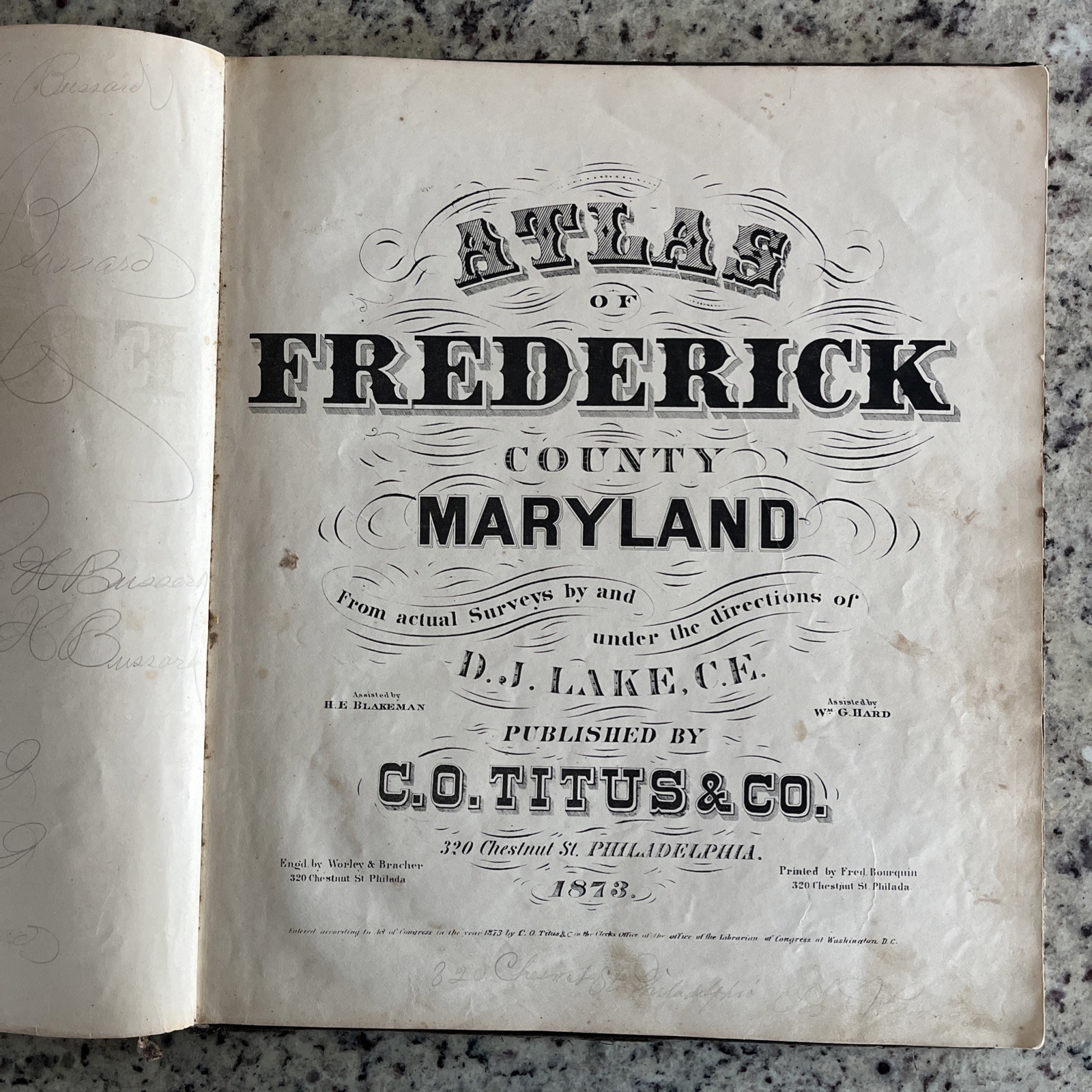
Here is an antique original 1873 Frederick County and City, Maryland atlas survey map book by famous surveyor, D. J. Lake and published by C. O. Titus & Co. It contains 33 detailed maps of Frederick County towns and countryside , specifically focusing on Frederick City, which was divided into 10 wards back in this era. This rare and valuable book of historical significance provides a unique glimpse into the geographic and cultural landscape of Frederick County Maryland in the late 19th century. It’s hard to find a complete book like this- many of them have been separated, with individual maps selling for $50 - $200. Also included, but not shown in photos, is a USA colored map, back when we only had 37 states!
All hand colored, engraved maps are in very good condition. The book measures 13.5” x 15.5” when closed. It is a hardcover cloth backed book. The spine has some splits, but the binding is sturdy and the book is complete. The first pages include antique calligraphy, indicating that this was owned by George Bussard and family.
Please see the photos I have provided. You will note that Brunswick was called Berlin back in 1873 and some town names were spelled differently than today. The Thurmont area was of course, Catoctin. The book also includes a business directory and population data on each town, including New Market, Urbana, Emmittsburg, Middletown, Jefferson and more.
If you have any questions, or need to see any additional photos, please reach out to me. Please see my other listings for more vintage and antique maps and atlases, including a very scarce 1946 Washington DC survey atlas book and a 1979 Frederick County real estate atlas. It’s neat to compare the Frederick County 1873 maps with the 1979 county surveys. I’m always happy to combine shipping on multiple items.