When you click on links to various merchants on this site and make a purchase, this can result in this site earning a commission. Affiliate programs and affiliations include, but are not limited to, the eBay Partner Network.
BEFORE THE PHONE TOLD YOU WHERE TO TURN — THERE WAS THE MAP.
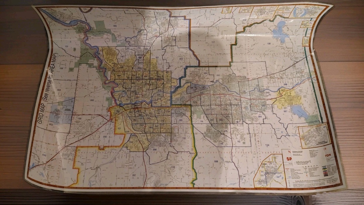
Original 2006 Spokane & Spokane County Grid Map produced by Northwest Map Service of Spokane, Washington.
This large laminated map covers Spokane and the surrounding Spokane County area, with detailed streets, numbered grids, major roads, communities and geographic boundaries. The reverse includes the larger Spokane County area map along with an extensive street/index reference.
The map includes Spokane, Spokane Valley, Cheney, Liberty Lake, Airway Heights, Medical Lake and surrounding Spokane County communities.
A cool piece of Inland Northwest history that\'s now roughly 20 years old—showing the Spokane area before another two decades of development changed the landscape.
Great for a Spokane history collection, local memorabilia, real-estate office décor, map collection, man cave, garage, workshop or anyone who remembers navigating without a glowing rectangle telling them they missed their turn.
Pre-owned and shows normal signs of age, use and storage. The map has been laminated, helping protect the printed surface. There is visible curling/creasing from storage and handling. Please review all photos closely for the exact condition and map coverage.
Published/produced by Northwest Map Service — Spokane, Washington.
2006 Edition.
Thank you for shopping D’Spencer Thrifts 616 and supporting my small business.
Make an offer. No reasonable offer not accepted.
📦 Carefully packed for shipping with heavy-duty protection and my shipping guarantee. I pack it like I want it arriving at my own door.
D’Spencer Thrifts 616 — Vintage wins every time.
One thing I\'d emphasize in the listing: 2006 and Spokane County. That\'s where the collectible/local-interest angle is—not just \"old map.\"