When you click on links to various merchants on this site and make a purchase, this can result in this site earning a commission. Affiliate programs and affiliations include, but are not limited to, the eBay Partner Network.
49.5 x 59.5 cm (19.5 x 23.4 in)
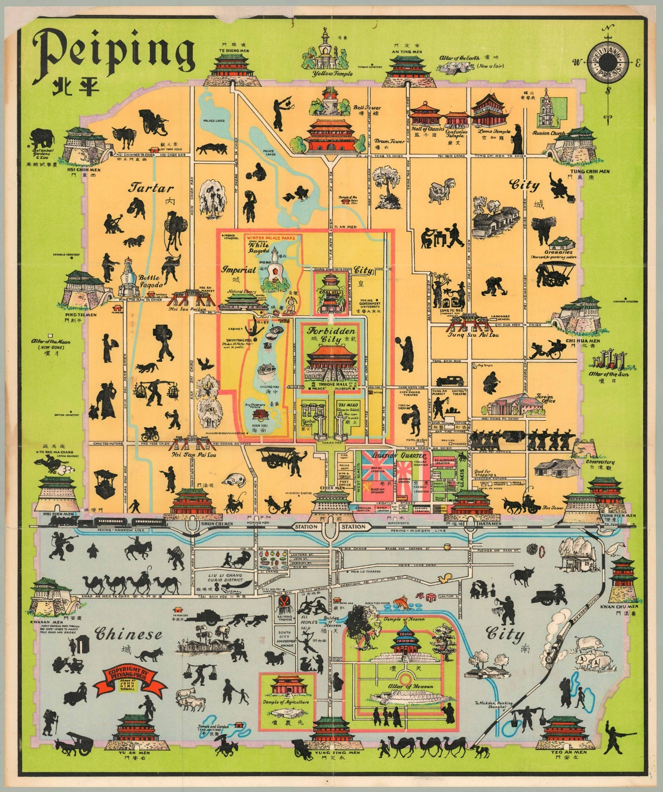
This is John Kirk Sewall\'s celebrated pictorial street map of the walled city of Beijing, with labels in both English and Chinese characters. It covers three main areas: the Tartar City, the Imperial City (including the Forofferden City) and the Chinese City, along with the Legation Quarter, the area where foreign legations were located between 1861 and 1959.
The map is decorated with small illustrations of landmark buildings and black silhouettes of workers, pedestrians, and animals. The map was published shortly after 1928, when the name \'Peiping\' first came into use when Nanjing (Nan-king) became the national capital. The German Legation is represented by the black, red and gold Reichsbanner flag, which was banned in 1933. As such, this map was issued between about 1928 and 1933.
The publisher\'s name is presented within the compass rose in the upper right corner; copyright by Peiyang Press on banner in lower left and below, in a yellow square, drawn by John Kirk Sewall.Census
OCLC/WorldCat lists only three examples, at the University of Michigan, the University of Victoria (British Columbia, Canada), and the Bayerische Staatsbibliothek in Germany..