When you click on links to various merchants on this site and make a purchase, this can result in this site earning a commission. Affiliate programs and affiliations include, but are not limited to, the eBay Partner Network.
Description
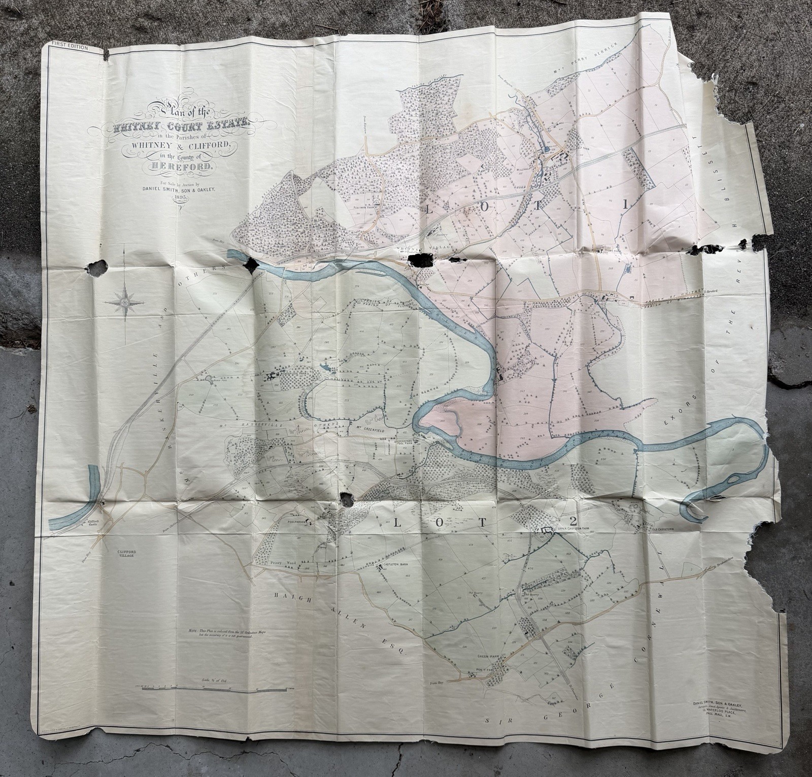
For your consideration is an original, rare primary document: a "Plan of the Whitney Court Estate" in the parishes of Whitney and Clifford, County of Hereford, dated 1895.
This detailed survey was produced for an sale conducted by the prestigious London firm Daniel Smith, Son & Oakley, located at 10 Waterloo Place, Pall Mall.
Historical Importance
This map is a significant piece of local and social history. In the late 19th century, land sale plans like this were essential instruments for the sale of large country estates. They provide an incredibly granular snapshot of rural England at the end of the Victorian era, detailing land usage, farm boundaries, woodlots, and infrastructure—such as the Whitney-on-the-Wye station—that defined the local economy and landscape of Herefordshire.
Who Should Buy This?
Local Historians & Genealogists: An invaluable resource for anyone researching the history of Whitney-on-the-Wye or Clifford parishes.
Cartography Collectors: A beautiful example of 19th-century commercial cartography, complete with period-accurate typography and hand-tinted land divisions.
Estate Collectors: Ideal for those who collect documents related to the dissolution of great British country houses or Victorian-era property history.
Interior Decorators: Its aesthetic appeal, combined with its historical provenance, makes it an excellent candidate for framing in a study or library.
Condition Note
This is an authentic antique document showing signs of age, including fold lines, edge wear, and specific circular perforations (likely from original binding or physical storage). Please review the high-resolution photos carefully to assess its current state.