When you click on links to various merchants on this site and make a purchase, this can result in this site earning a commission. Affiliate programs and affiliations include, but are not limited to, the eBay Partner Network.
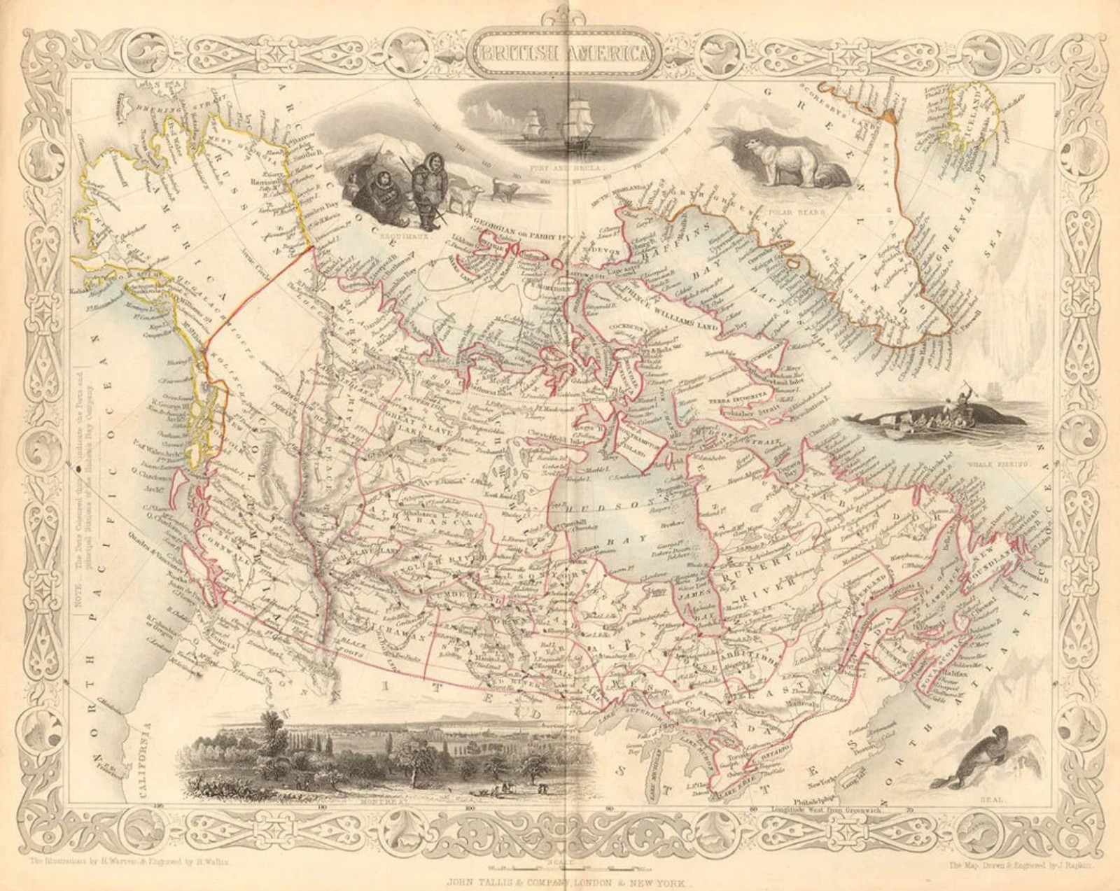
Step into the early geography of Canada and the fur trade era with this authentic mid-19th century engraved map of “British America”, published by John Tallis & Co. (c. 1849) and engraved by J. Rapkin, one of the most recognized cartographers of the Victorian period.
This map captures a fascinating moment in North American history—when vast regions were still defined by exploration, trade routes, and the influence of the Hudson’s Bay Company, whose forts and stations are clearly marked throughout the territory.
- ✔ Original 1849 steel engraving (not a reproduction)
- ✔ Published by John Tallis & Co., London & New York
- ✔ Engraved by J. Rapkin, with vignette illustrations by H. Warren
- ✔ Original outline hand coloring
- ✔ Decorative border typical of Tallis atlas maps
- ✔ Displays Hudson’s Bay Company forts and trading network
- ✔ Shows “Russian America” (Alaska) prior to the 1867 U.S. purchase
- ✔ Includes vignette scenes: Inuit (Esquimaux), polar bears, whale fishing, Montreal, and Arctic exploration
- Approx. 27 x 34 cm (10.5 x 13 inches)
This map reflects Canada during the height of the fur trade economy, when much of the interior was mapped through trade routes and company outposts rather than formal settlement. It is especially sought after for its depiction of the Hudson’s Bay Company’s reach across the continent, making it a strong piece for collectors of Canadian, colonial, and trade history.
All Zagros Artifacts items are guaranteed authentic as described or your money back! ✨
Check out our website for ancient and authentic Persian artifacts! 🦁