When you click on links to various merchants on this site and make a purchase, this can result in this site earning a commission. Affiliate programs and affiliations include, but are not limited to, the eBay Partner Network.
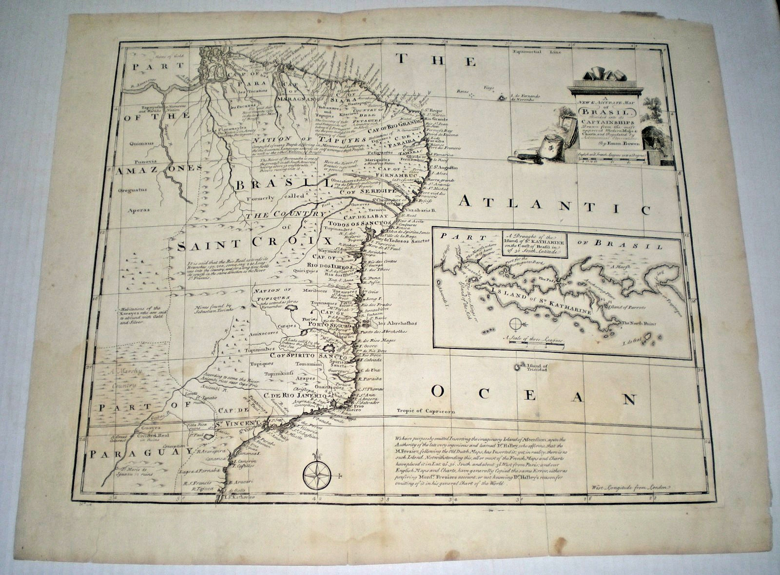
Authentic, original 18th-century copperplate engraving: "A New & Accurate Map of Brazil. Divided into its Captainships..." by the highly celebrated English Royal Geographer Emanuel Bowen. This specific sheet was published in London circa 1747 for his monumental work: "A Complete System of Geography." This historic map captures colonial Brazil at the height of the Portuguese gold rush. It is highly prized by collectors for its extensive, fascinating text annotations detailing early explorer tracks, river navigation, and areas "abounding with gold." It also features a striking Baroque/Rococo title cartouche showcasing a Native American figure next to an overflowing bag of wealth, alongside a detailed inset map of the Island of St. Katherine (Santa Catarina).
Condition Report:
Paper & Margins: Full original margins and deep plate marks.
Toning & Watermarks: Displays very light, honest age-toning. There are a few old, very pale, and unobtrusive water marks on the paper that do not detract from the striking central image.
Repairs & Folds: Vertical centerfold line as issued. Professional, acid-free archival tape has been neatly applied to the reverse side to cleanly mend and stabilize a minor tear along a fold line.
Color: Original uncolored (black and white) state, showcasing the copper engraving lines.
Pak30 Our 27th year on



![Emanuel von Baeyer Dominique-Vivant Denon [1747-1825] and his Circle picture](/store/img/g/6wAAAeSwu7Zqllzn/s-l225/Emanuel-von-Baeyer-Dominique-Vivant-Denon-1747-182.jpg)