When you click on links to various merchants on this site and make a purchase, this can result in this site earning a commission. Affiliate programs and affiliations include, but are not limited to, the eBay Partner Network.
Brand/Publisher: Texaco Inc.; cartography by Rand McNally & Company, U.S.A.
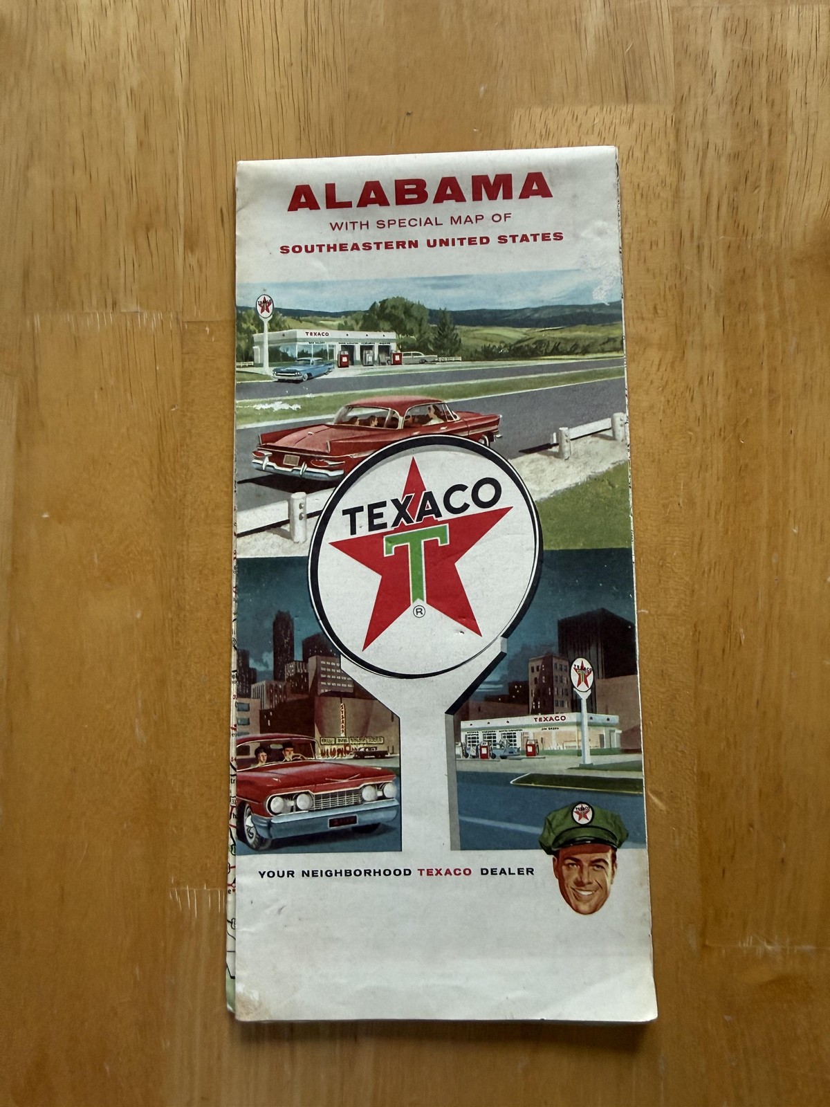
Item: Vintage Texaco touring highway map of Alabama with a special regional road map of the Southeastern United States, distributed through Texaco service stations and branded with Texaco logos and Texaco National Credit Card advertising.
Front folded cover is headed "ALABAMA with special map of SOUTHEASTERN UNITED STATES" above an illustrated Texaco service scene showing red automobiles at suburban and downtown Texaco stations, centered on the large Texaco star sign and finished with the tagline "YOUR NEIGHBORHOOD TEXACO DEALER" and a portrait of a uniformed Texaco attendant.
Back cover features advertising copy beginning "Power-up for Peak Performance with Texaco Gasolines," promoting Sky Chief premium gasoline and Fire Chief regular-price gasoline for motorists throughout the 50 states and Canada, together with a large script heading "Texaco National Credit Card" and an illustrated example credit card showing identification number, customer name, address line "MAIN ST ANYWHERE U S A," and explanatory text about credit card use.
Interior Alabama side is titled "Texaco Touring Map of Alabama" and presents a large multicolor road map of the state with U.S. highways, state routes, county and state boundaries, rivers, and cities, keying principal routes in red and secondary roads in contrasting colors, accompanied by a legend panel explaining symbols, route types, and speed classifications together with a population of cities and towns table.
Upper margin carries an "Alabama Index" listing cities and towns alphabetically with grid references, while the lower portion includes detailed inset street maps of Birmingham, Mobile, and Montgomery, each labeled with city name and state abbreviation, plus an "Alabama–Mississippi Mileage Chart" and a small "Principal Radio Stations" table; corner medallions repeat the "Tour with Texaco" slogan.
Reverse side opens to a large map titled "Road Map of Southeastern United States" showing a broad swath of the southeastern region with main through routes emphasized in red, additional U.S. and state highways, rail lines, rivers, and coastal outlines, framed by a mileage scale, Texaco compass rose, and legend box noting that principal routes are highlighted, together with a copyright credit to Rand McNally & Company.
At right, a tall index panel lists cities and towns by state for the Southeastern map, and a separate inset titled "Southern Florida" at matching scale focuses on the Florida peninsula and Keys, extending coverage south from the main map and repeating the Texaco star emblem at the lower border.
Format and appearance: Large double-sided accordion-fold paper highway map printed in multiple colors, designed for glove-compartment or travel use, combining a detailed Texaco touring map of Alabama with a companion regional road map of the Southeastern United States and extensive service-station and credit-card advertising.
Collectibility: Desirable piece of Texaco gas and oil advertising ephemera and mid-20th-century American highway history, of interest to collectors of vintage road maps, Rand McNally cartography, and Alabama and Southeastern U.S. motoring memorabilia.