When you click on links to various merchants on this site and make a purchase, this can result in this site earning a commission. Affiliate programs and affiliations include, but are not limited to, the eBay Partner Network.
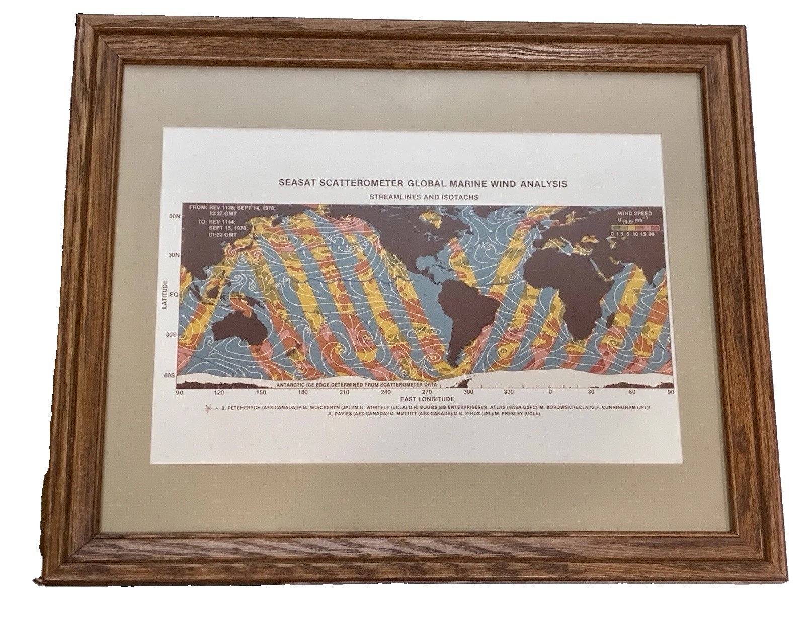
Vintage NASA/JPL Seasat scatterometer poster, "Global Marine Wind Analysis: Streamlines and Isotachs," derived from satellite data spanning September 14–15, 1978 (Rev 1138–1144). Seasat was NASA's first satellite dedicated to remote sensing of the world's oceans — it operated for only about 105 days before a power failure ended the mission in October 1978, making surviving mission-era material like this relatively scarce.
The chart maps global marine wind streamlines and speed isotachs across a wide swath of latitude/longitude, credited to a joint team from JPL, AES-Canada, UCLA, and NASA-GSFC (S. Peteherych, P.M. Woiceshyn, M. Wurtele, and others).
Comes framed and matted, approximately 13" x 18" overall. Frame shows light wear consistent with age and prior display/storage; a period pencil notation and archival stamp are visible on the backing board (verso), adding to its documented history.
From a Los Angeles collection. Item is offered as-is based on visual inspection and printed content. Please review all photos carefully and message with any questions before purchasing.
Great addition for NASA/JPL collectors, space history enthusiasts, meteorology/oceanography buffs, or as a striking science-themed wall piece.
Local pickup available in the Los Angeles area; will also ship securely (frame and glass permitting — confirm before purchase if shipping is needed, as this may require custom packing).