When you click on links to various merchants on this site and make a purchase, this can result in this site earning a commission. Affiliate programs and affiliations include, but are not limited to, the eBay Partner Network.
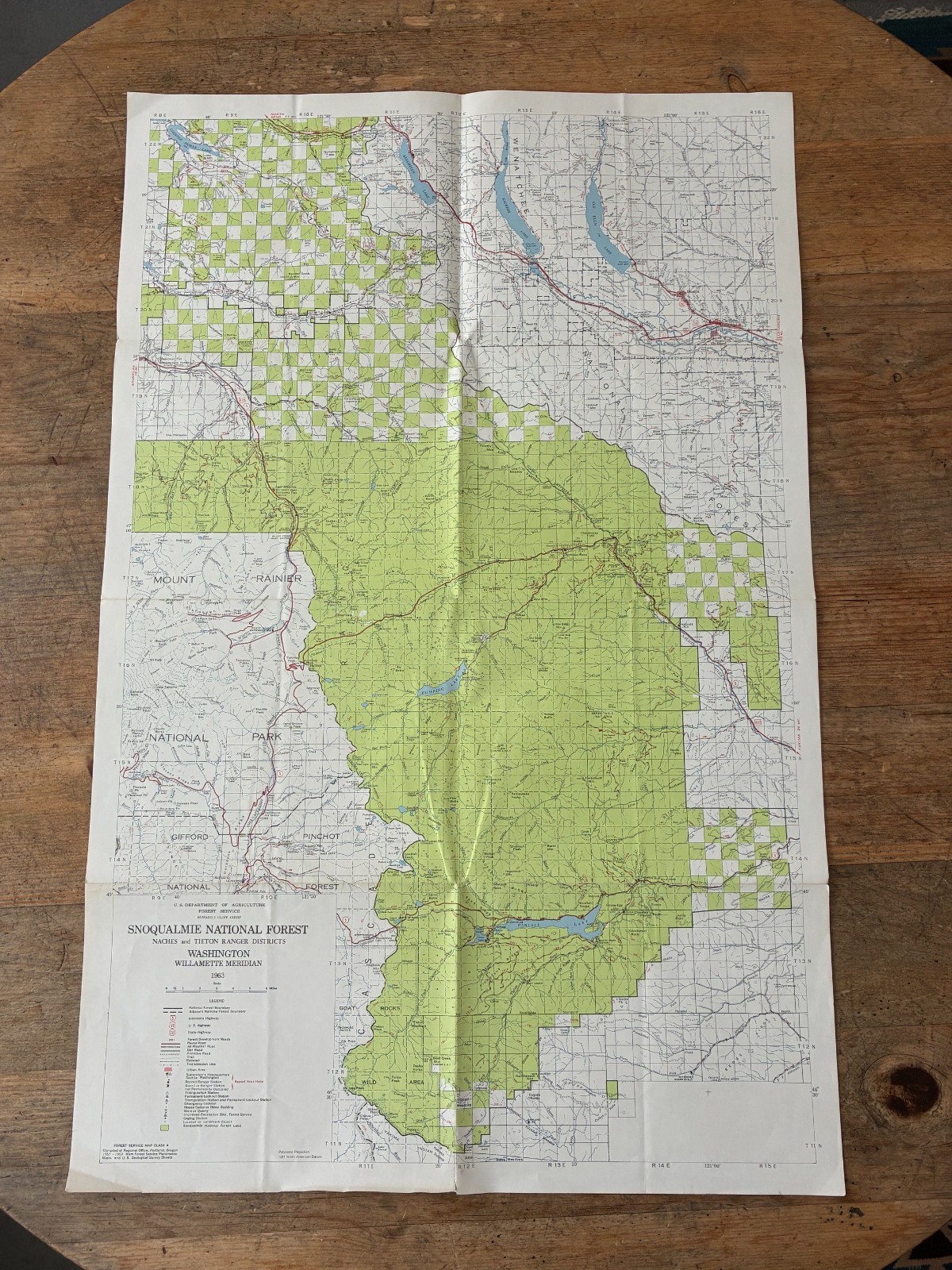
Published by the U.S. Department of Agriculture, Forest Service and clearly dated 1963.
A large and highly detailed colour map showing Snoqualmie National Forest and the surrounding central Washington landscape. Coverage includes the Naches and Tieton Ranger Districts, with part of Mount Rainier National Park shown to the west, together with the Wenatchee area to the north.
The map shows National Forest land and boundaries, roads, trails, railways, ranger stations, lookout stations, recreation sites, lakes, rivers, settlements and numerous other geographical features. The legend also identifies Forest Service facilities and different types of roads and trails.
The lower margin states that the map was compiled at the Regional Office in Portland, Oregon, in 1957–1958 from Forest Service planimetric maps and U.S. Geological Survey sheets, with the finished map dated 1963.
Condition: Good vintage condition for its age, retaining the original fold lines with expected light creasing and minor age-related edge wear. There is a small tear at the bottom edge along one of the fold lines, shown clearly in the photographs. The tear is confined to the edge and the map otherwise remains well preserved, with strong colour and clear printed detail. Please study all photographs carefully for condition.
An attractive original period Forest Service map for collectors of Washington State, Snoqualmie National Forest, Mount Rainier, the Cascade Range, US Forest Service material and vintage American cartography.
Combined postage available when purchasing more than one map – please message before payment.