When you click on links to various merchants on this site and make a purchase, this can result in this site earning a commission. Affiliate programs and affiliations include, but are not limited to, the eBay Partner Network.
Set of 9 Maps
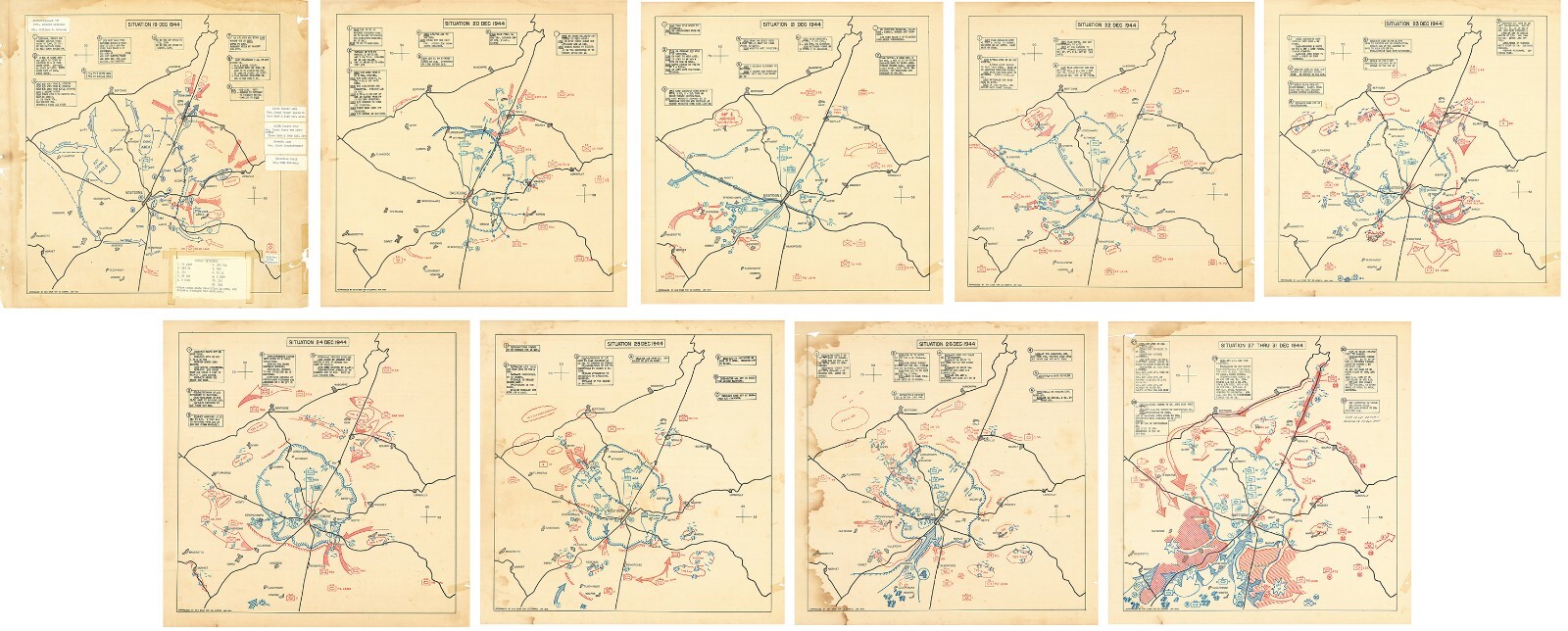
664 Engineer Topographic Combat Company, US Army(Second World War - Battle of the Bulge - Siege of Bastogne) SITUATION 19 DEC 1944 [with identical formats for 20, 21, 22, 23, 24, 25, 26 and 27-31 December 1944]
Reproduction
-see more info below-
Detailed Specifications
This is a modern reproduction of the original map.
These Maps Comes in Sizes:
9 x 11\"x11\",
9 x 16\"x16\" and
9 x 23\"x23\"
We have more War Maps, you can find them in
Our Store
We have moreWar Posters,you can find them in
Our Store
All Our Maps and Posters Are Made in the USA
REMEMBER, the smaller the map size the harder it is to read the text.
Exceptional set of maps of the Siege of Bastogne produced by the 664 Engineer Topographic Corps and vividly portraying the unrelenting violence faced by the American forces during the battle.
These maps, published less than a month after the siege was lifted, provide an unparalleled cartographic insight into the progress of the war and are some of the most near-contemporaneous printed battle maps to appear during the conflict.
All of the maps have the same base. The first eight maps depict the daily progress of events from December 19th to the 26th, while the events of the 27th through 31st are compressed on a single sheet. The design of the maps is striking: on the one hand they are minimalist in limiting geographic information to the tracks of roads and the locations of villages and towns; on the other, each sheet depicts the movements of dozens or hundreds of American (blue) and German (red) infantry, mechanized, and artillery units. Blocks of text describe events hour by hour, even for very small units. One of the more interesting features is the use of symbols to represent combat units: the abstract and highly-standardized iconography used by the Army is complemented throughout by the use of informal pictorial elements to represent bombardments, airdrops, tanks, and so on. This is particularly the case from the 23rd of December onwards when the skies begin to fill with tiny blue American planes.
This map comes with a white border around the image----------------------------How are the prints shipped?They are rolled and placed into a rigid tube or box.
-Is this available in a larger/smaller size.For smaller or larger sizes, email us.
- Printed on premium 36lb matte paper with fade resistant archival inks and includes a white border on all sides to allow for matting and framing.
- Please note that there may be some variation in the color of the on-screen image and the actual item received. This is subject to the brightness and contrast of your screen settings.
- This is a modern UNFRAMED reproduction of the original print - Frames are NOT Included.