When you click on links to various merchants on this site and make a purchase, this can result in this site earning a commission. Affiliate programs and affiliations include, but are not limited to, the eBay Partner Network.
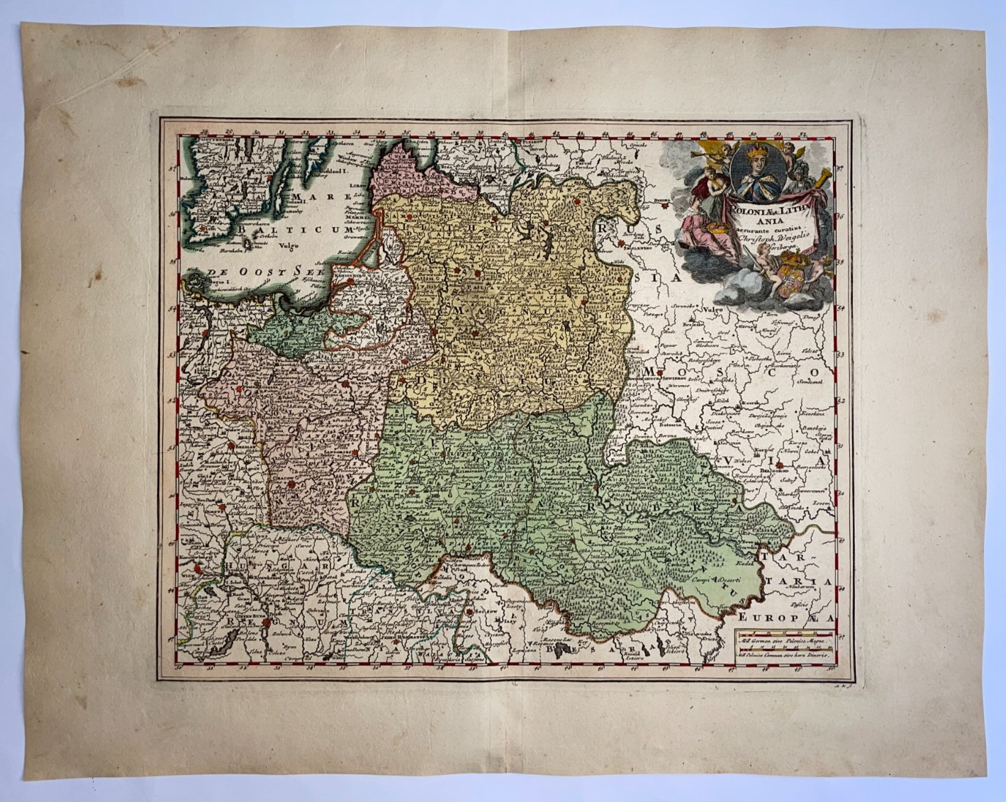
Title of the map:
\"Poloniae & Lithuania accurante curatius Christoph Weigelis Noribergae\"
Large unusual antique copper engraved map of Poland and Lithuania, by Christophe Weigel. The map depicts the Baltic states too, and the area from the Baltic Sea to the Black Sea with Poland, Estonia, Latvia, Lithuania, Belarus and Ukraine. In right top, a beautiful cartouche.It features someallegorical female figures,military trophies,heraldic symbols. Someclouds and drapery surrounding the title, anda royal portrait medallion.
The map depicts of the Polish–Lithuanian Commonwealth, one of Europe\'s largest states during the early eighteenth century. It includes of Ukraine,portions of western Russia, andeastern Prussia.Major cities visible includeWarsaw,Kraków,Vilnius,Danzig (Gdańsk),Königsberg,Minsk,Lviv, andSmolensk.
On back, the name and the number of the map in handwritten writing of the era.
From \"Atlas scholasticus et itinerarius\" by Christ. Weigel, a famous travel atlas in collaboration with professor Johann David Köhler.
Size with margins :46,5 x 37,5 cm / 18,1 x 14,5 inches
Condition :very good condition, old colors, on strong paper.
Edition: Nuremberg, c. 1718, 18th century.
Christoph Weigel (1654-1725), sometimes known as Christoph Weigel the Elder, was a prominent 18th-century German engraver, art dealer and publisher. He married the daughter of the eminent engraver and publisher Johann Christoph Lochner, who later integrated him into the artistic community of Nuremberg.
Weigel’s maps are particularly remarkable for their detail and precision. One of Weigel’s important contributions is his participation in the production of the \"Atlas scholasticus et itinerarius\", a comprehensive world atlas that was widely used in educational circles. In addition to his cartographic efforts, Weigel produced a wide range of illustrations for books on various subjects, ranging from history to the natural sciences. His illustrations were known for their clarity and detail, contributing to the spread of knowledge at a time when visual representations were crucial for cartography. Christoph Weigel died in 1725, leaving behind a work that continues to be appreciated for its artistic merit and historical value.
If you buy more than one item, you have to pay just one only shipping cost. We will send your item by Registered and Insured Airmail or by DHL with covering insurance. Customs may be charged on international shipments. All customs charges are the responsiblity of the buyer and are not included in the selling price.
A Certification of Authenticity can be issued on request.
View our Other Items For Sale
WE DON\'T SELL LASER AND COPIES MAPS, ALL WE SELL IS ORIGINAL AND ANTIQUE.
Due to the age an type of paper, some imperfections are to be expected. Please examine the images provided carefully, and if you have any questions please ask and we will be happy to help you.