When you click on links to various merchants on this site and make a purchase, this can result in this site earning a commission. Affiliate programs and affiliations include, but are not limited to, the eBay Partner Network.
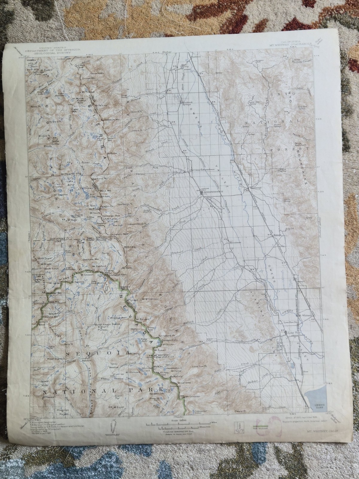
Original United States Geological Survey topographic map of the Mount Whitney Quadrangle, California.
This detailed map covers the Mount Whitney region of the Sierra Nevada, including Mount Whitney, Sequoia National Park, Owens Valley, Independence, Mount Muir, Mount Stanford, Mount Gould, Kearsarge Pass, Mount Kaweah, and numerous alpine lakes, peaks, canyons, and trails.
The map was originally surveyed in 1905 and revised in part in 1937. It is marked:
Edition of 1907, reprinted 1939
Printed on paper and professionally cloth-backed for durability.
An outstanding early USGS map depicting one of the most famous mountain regions in the United States, including the highest point in the contiguous United States.
Condition: Vintage condition with age toning, fold wear, edge wear, minor creasing, and handling marks consistent with age. Cloth backing remains intact. Please review all photographs carefully for exact condition.
Details:
United States Geological Survey
Mount Whitney Quadrangle
California
Original Edition 1907
Reprinted 1939
Surveyed 1905
Revised in part 1937
Scale 1:125,000
Contour interval 100 feet
Cloth-backed
Original vintage map, not a reproduction
Map will be rolled and shipped in a tube.