When you click on links to various merchants on this site and make a purchase, this can result in this site earning a commission. Affiliate programs and affiliations include, but are not limited to, the eBay Partner Network.
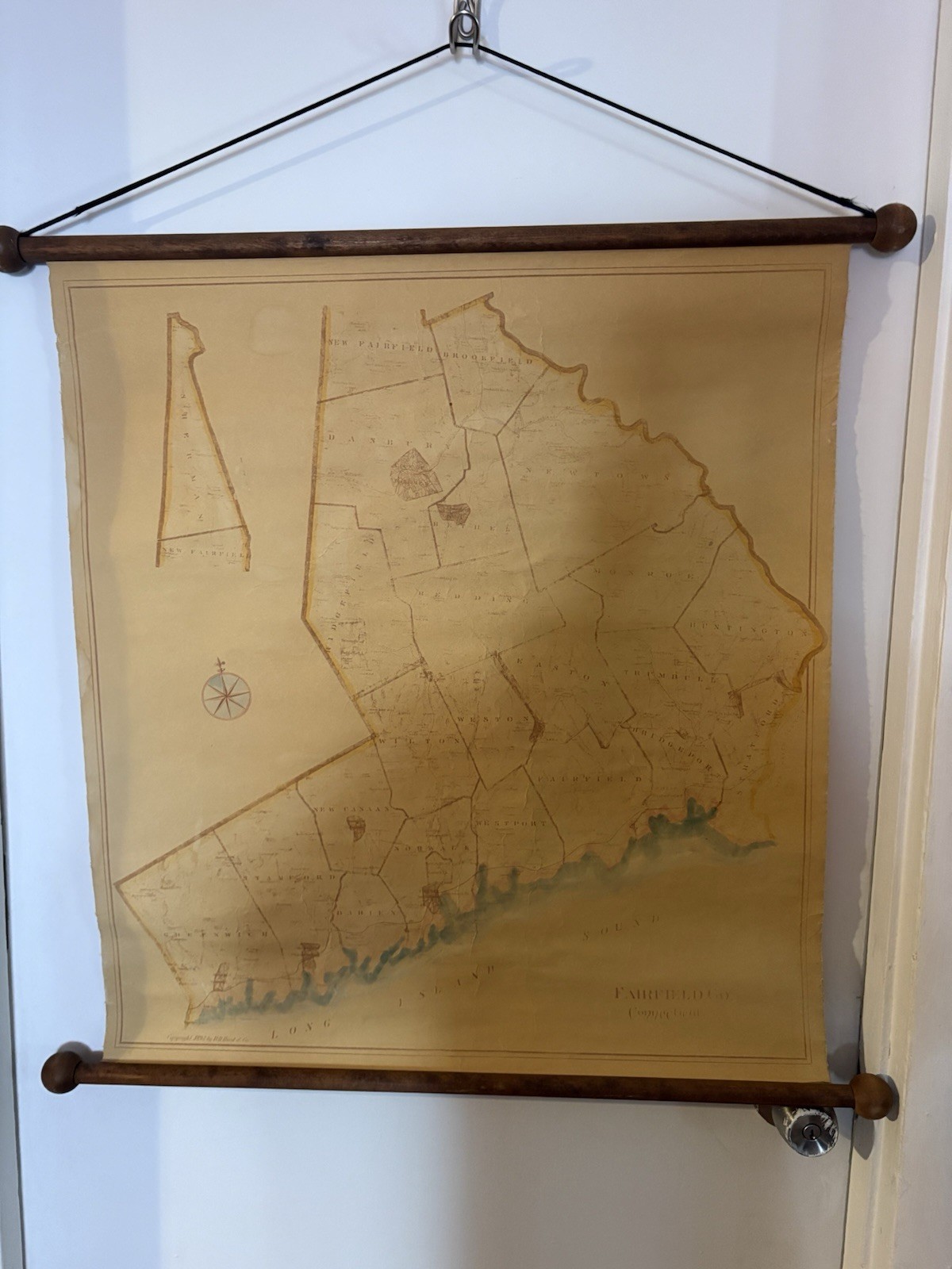
Up for sale is a genuine, authentic 1893 Antique Fairfield County, Connecticut Wall Map published by D.H. Hurd & Co. This is a stunning piece of late 19th-century cartography, perfect for historical research, local genealogy, or as a premier vintage statement piece for home or office decor.
Unlike common paper reprints, this original map is backed by heavy canvas/linen, which has allowed it to survive over 130 years. It features its original wooden top and bottom rollers, complete with the hanging cord still attached and ready to display.
Geographic Details Included:
The map showcases detailed local geography of coastal and inland Fairfield County, featuring prominent historical areas and borders including Greenwich, Stamford, Darien, Norwalk, Westport, Fairfield, Bridgeport, and Long Island Sound.
Dimensions:
Map Height: Approx. 28 inches
Map Width: Approx. 25 inches (Linen edges)
Total Wood Roller Width: Approx. 26.5 inches
Condition Report:
This map is in Good Antique Condition with a beautiful, authentic aged patina.
Linen/Canvas: Strong and intact. There are typical age-related amber toning, water staining/tide lines along the bottom coastal edge, and minor surface wear as shown in the photos. No major tears that compromise the map's integrity.
Wood Rollers: Original wooden dowels and decorative end knobs are fully intact, solid, and tightly secured to the canvas.
Please review all high-resolution photos carefully (including tape measure views) to judge the exact cosmetic condition for yourself.