When you click on links to various merchants on this site and make a purchase, this can result in this site earning a commission. Affiliate programs and affiliations include, but are not limited to, the eBay Partner Network.
The Prints Collector
Original Antique Maps and PrintsABOUT USVISIT OUR STORE
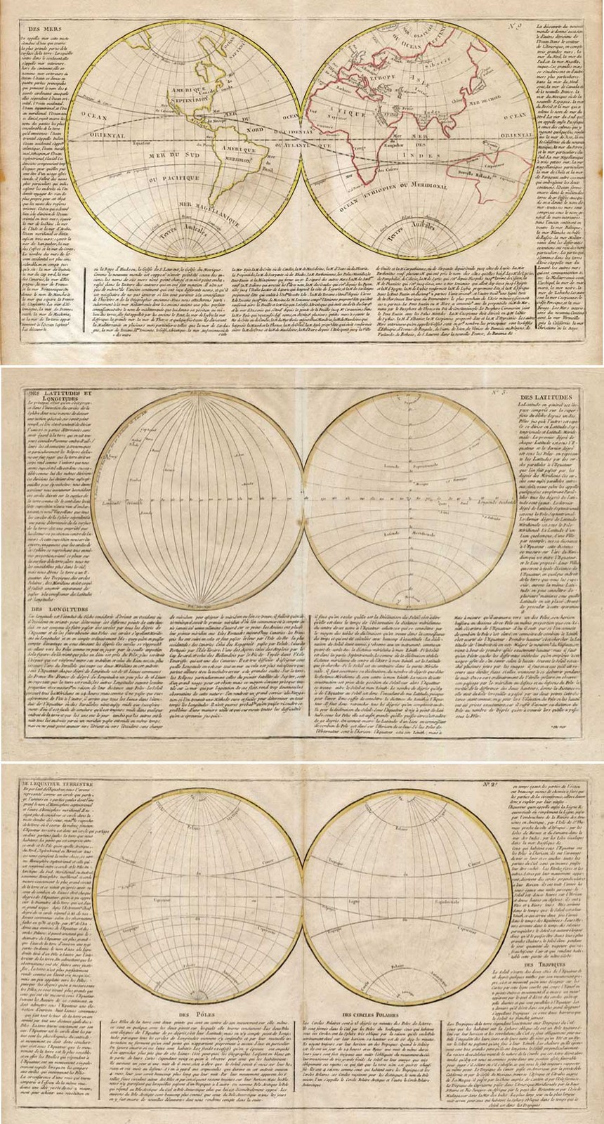
3 Antique Maps-WORLD-USA-HEMISPHERE-18th c
Description: Source unknown, but defrinatively 18th c. maps from Atlas.Artists and Engravers: Unknown.
Subject: Map : \'World Map\'. (World Map.) Set of 3 maps. Copper Engravings, double hemisphere World map. Original outline hand colour. The other 2 maps deal with the Northern and Southern Tropics and the longitudes and latitudes of the Earth.
Condition: Fine; general age related toning; some light staining from handling.
Size (in cm): The overall size is ca. 59.5 x 43.5 cm. The image size is ca. 56 x 32 cm.
Size (in inch): The overall size is ca. 23.4 x 17.1 inch. The image size is ca. 22 x 12.6 inch.
Medium: Copperplate engraving on verge type hand laid paper with watermark. Original hand colour.
Location: B17-27
SKU: TPC 13670.1
Section: VARIOUS
ThePrintsCollector - LaurentiusOldMasterPrints
Frans Laurentius
Margo van Latum-van Dongen, Frank van Latum
Located in Zeeland (Noord-Brabant)- The Netherlands
Free worldwide shipping on all orders of $70 or more.
We ship our items to all locations worldwide.
We ship within two business days upon receipt of payment.
We ship by registered mail. Insurance is included.
GO TO OUR STORE and explore our huge collection of fine antique maps and prints.
We only accept payments via Paypal.
Combined orders are possible! We will send a Paypal invoice on request!
THE PRINTSCOLLECTOR GUARANTEES ITEMS SOLD THROUGH ARE GENUINE ORIGINAL
ANTIQUE PRINTS IN THE CONDITION/TECHNIC AS DESCRIBED. ITEMS CAN BE RETURNED WITHIN 30 DAYS.